
La Niñas on the rise in climate change double whammy
The El Niño Southern Oscillation is a natural fluctuation of ocean temperatures in the equatorial Pacific that can give rise to El Niño and La Niña, which drive droughts and floods from South East Asia and Australia to the Americas.
Climate change is predicted to double the number of extreme El Niños this century. Now it seems there will be almost twice as many extreme La Niñas as well.
El Niño happens once every five years or so, taking the rain away from South East Asia and Australia – causing drought and fire – and dumping it on the west coast of the Americas – causing floods and mudslides. La Niña, which occurs with similar frequency, has more-or-less the opposite effects.
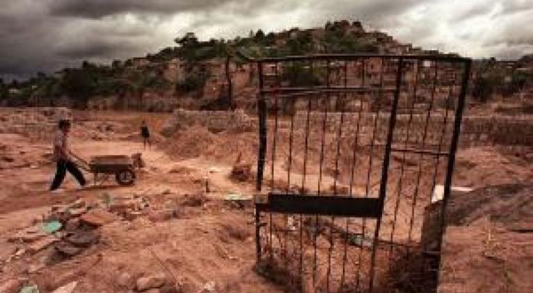
When they are particularly strong, or extreme, the impacts of these events are devastating. The 1997 El Niño, for example, is estimated to have killed 23,000 people and caused $45 billion worth of damage. The following year an extreme La Niña caused flooding so severe that it displaced 200 million people in China, submerged half of the land mass of Bangladesh, and spurred on the North Atlantic hurricane season, where the deadliest hurricane in history occurred, Hurricane Mitch.
Double trouble
Such extreme events have been rare over the previous century – extreme El Niños happening once every 20 years and La Niñas every 23 years . But from now on, they will occur more frequently.
Extreme El Niños are predicted to occur twice as frequently because climate change is warming waters near Peru faster than those near Indonesia, mimicking El Niño itself. As a result, an extreme El Niño is less of a perturbation from the new normal state of affairs.
What was not certain was whether the world would be spared the wrath of El Niño's sister.
No such luck. Extreme La Niñas will also almost double. That's according to Wenju Cai at the CSIRO in Melbourne, Australia, whose team ran 21 climate models with data on past and future carbon emissions to see what would happen.
What he saw was one of the worst scenarios possible: 17 out of 21 models showed a rise in El Niña, and the average increase across all models was 74 per cent. This means that despite the more frequent El Niño-like conditions, we should now expect an extreme La Niña once every 13 years instead every 23, as we've seen over the past century.
Ocean see-saw
The uneven warming of the Pacific Ocean is setting up a kind of see-saw, says Cai. "That means that the system swings between two extreme opposites," Cai says. "It is rather counter-intuitive because the mean state is El Niño-like."
In addition, extreme El Niños themselves – which are increasing in frequency – set up the conditions for extreme La Niñas. As hot water is discharged from the equatorial waters during El Niño, deeper cooler water can rise to the surface, creating the cold patch that defines La Niña.
Cai says the double-whammy can multiply the impacts of each extreme event. "In 2011 in Australia, we just got out of the drought, and then there is a forecast of a La Niña," he says. "So farmers, after suffering from 10 years of drought, invest heavily in crops. And then they are flooded."
Model answers
How much confidence we should have in such model simulations has experts divided.
"It looks like most of their extreme La Niñas are the ocean sloshing back after extreme El Niños," says Mark Cane from Columbia University in New York. "This is interesting and could be real." However, Cane says he has little faith in models for studying how extreme ENSO events will change.
Kevin Trenberth from the National Center for Atmospheric Research in Boulder, Colorado, says the results need to be taken with a pinch of salt. This is because some models produce "wimpy" ENSO events, while others produce larger ones, he says.
"Clearly going from El Niño to La Niña constitutes a form of whiplash," Trenbert says. But he adds that it is the lack of predictability that really causes the problems, and our ability to predict El Niño is improving. "So the ability to plan for and adapt to the events can offset any changes in amplitudes."
Journal reference: Nature, DOI: 10.1038/nclimate2492


Add new comment